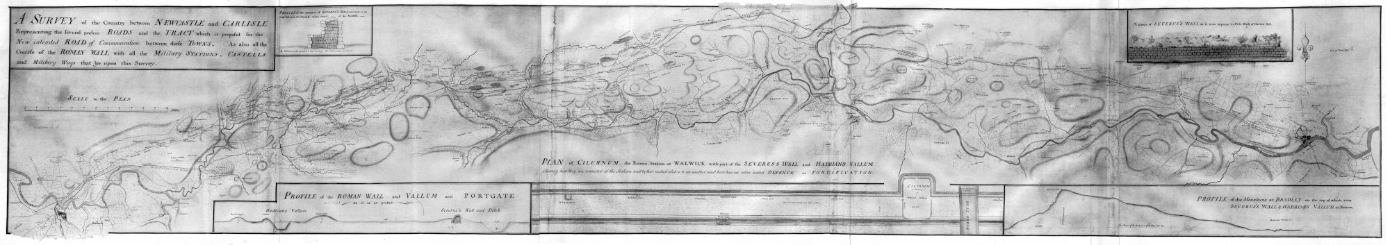
Campbell and Debbeig’s brief was to survey a new road between Newcastle and Carlisle, hence the western (Bowness to Carlisle) and eastern (Newcastle to Wallsend) extremities of the Wall were not included in their map. Their place name spellings often differ from their modern day equivalents in some places (e.g. Shewen Shiels is modern Sewingshields), names only being formalised later with the Ordnance Survey name books.
One interesting aspect of the Campbell and Debbeig map is the merciless way in which it was ripped off by Nathaniel Hill to make the map for Warburton’s Vallum Romanum (the text for which was heavily ‘inspired’ by Horsley’s), and it was this map that William Hutton took with him for his walk along the Wall in 1801.
The copy of one of the original manuscript maps reproduced here was originally published to accompany the article ‘The original survey for the Newcastle Carlisle Military Road’ by G. R. B. Spain in Archaeologia Aeliana for 1937.
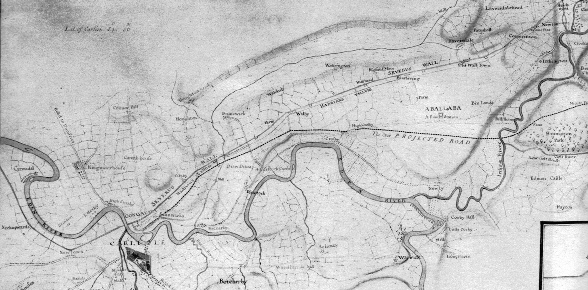
Western end of Campbell and Debbeig’s survey (Carlisle to Castlesteads) 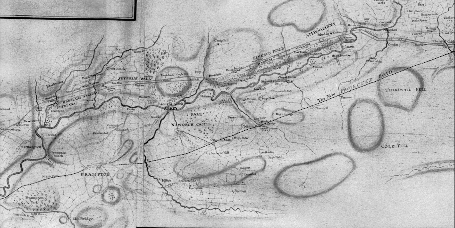
Campbell and Debbeig’s survey (Castlesteads to Birdoswald) 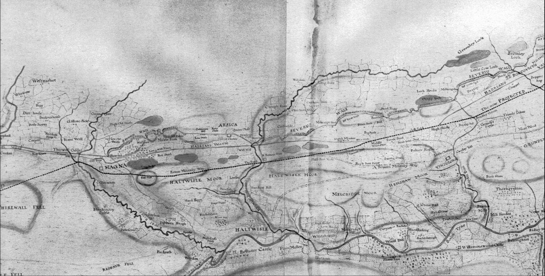
Campbell and Debbeig’s survey (Birdoswald to Housesteads) 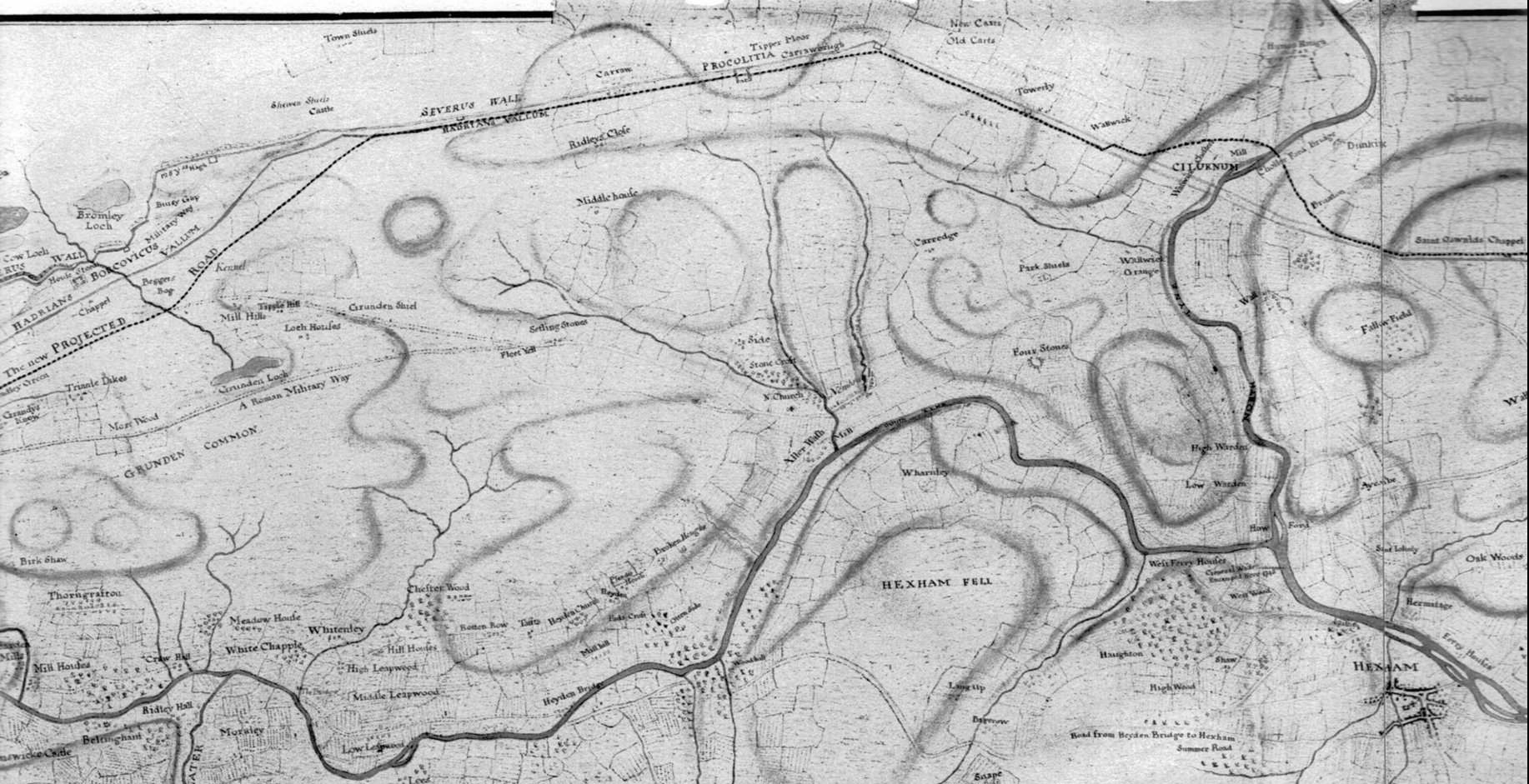
Campbell and Debbeig’s survey (Housesteads to Chesters) 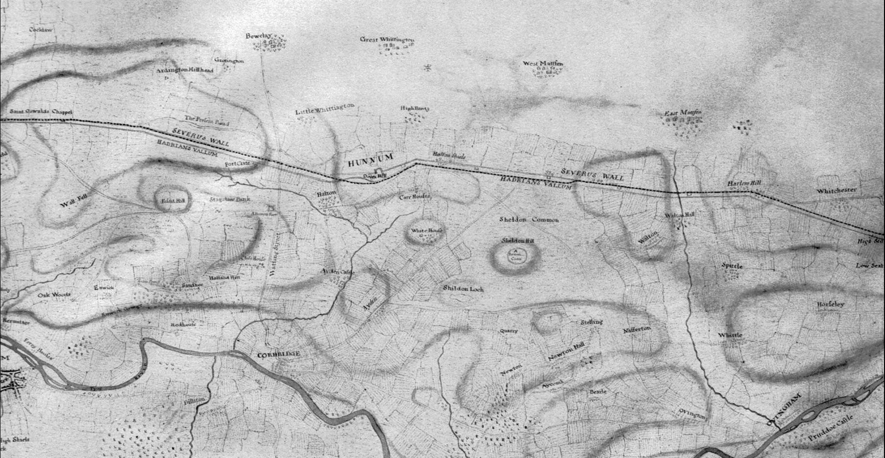
Campbell and Debbeig’s survey (Chesters to Rudchester) 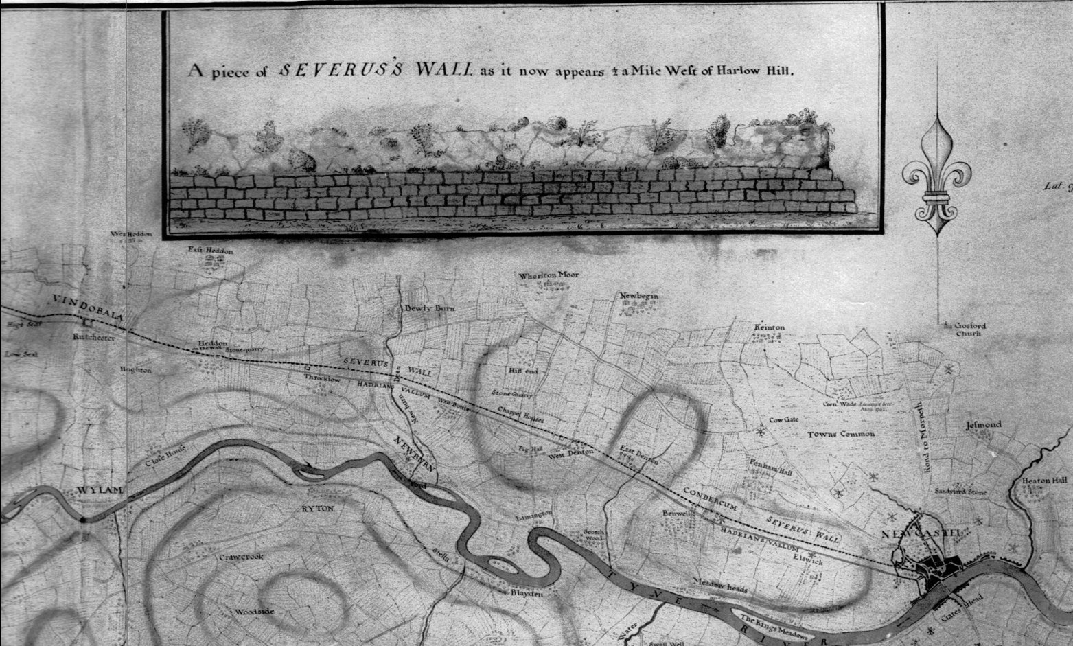
Eastern end of Campbell and Debbeig’s survey (Rudchester to Newcastle)